Nature Trails at Plymouth Bluff
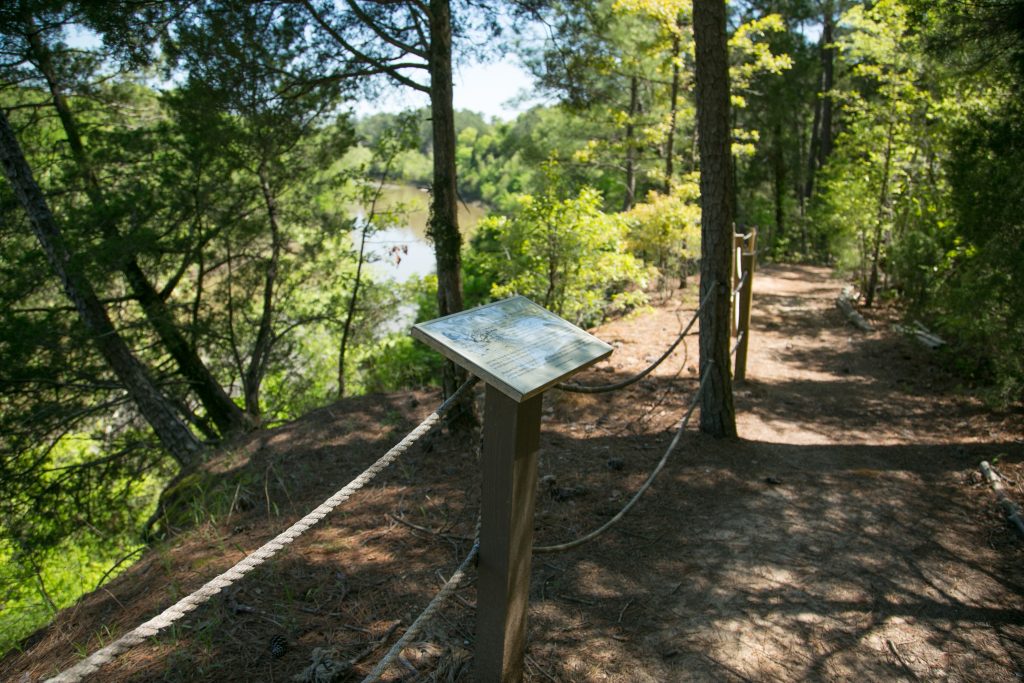
Plymouth Bluff Center features five miles of trails that wind through a variety of natural areas ranging from floodplain forest to upland mixed hardwoods. Most of the trails are surfaced with asphalt or crushed limestone. Interpretive signs along the trails identify some of the plants and provide interesting notes about them. Several of the signs contain notes about the cultural history of the area.
Boy Scouts of the Pushmataha Area Council have contributed significantly to the development and maintenance of the trail systems at Plymouth Bluff, beginning as early as 1982. Their work has included marking and clearing sections of trails, building footbridges, steps, rest areas and kiosks, and general maintenance. During the past 30 years, more than three dozen Eagle Award service projects have been completed. These Eagle Scouts are recognized on the kiosks at the beginning of the trail systems.
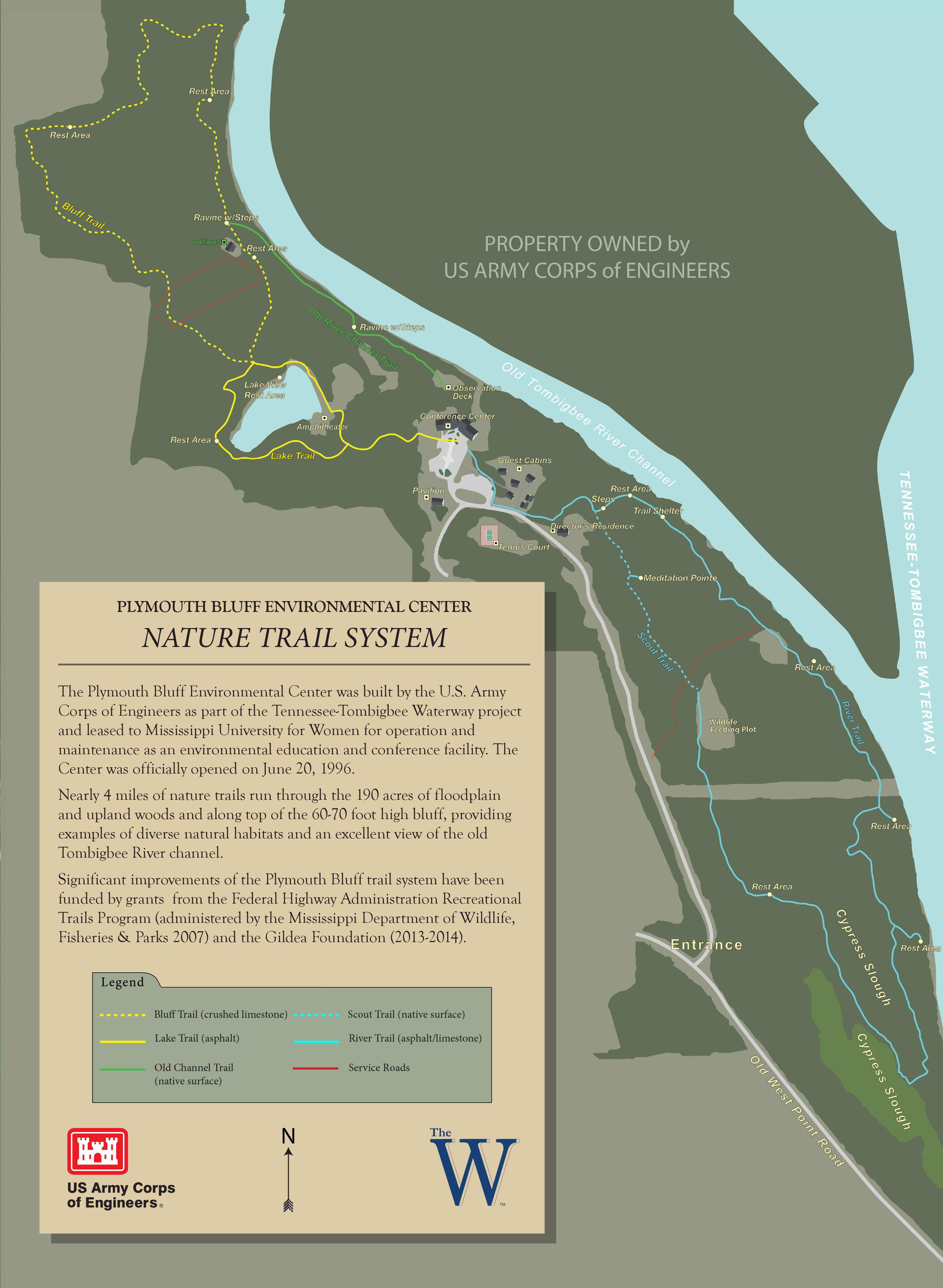
Nature Trail System
Nearly 5 miles of nature trails run through the 190 acres of floodplain and upland woods and along top of the 60-70 foot high bluff, providing examples of diverse natural habitats and an excellent view of the old Tombigbee River channel.
The Lake Trail
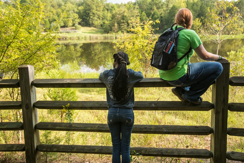
This asphalt trail begins at the conference building parking lot and becomes a loop around the lake (past the amphitheater). The total distance from the parking lot around the lake and back is 0.65 miles. This is a shorter distance from beginning to end than any other part of the Plymouth Bluff trail system. A short segment of the Lake Trail is rather steep and may be difficult for some users.
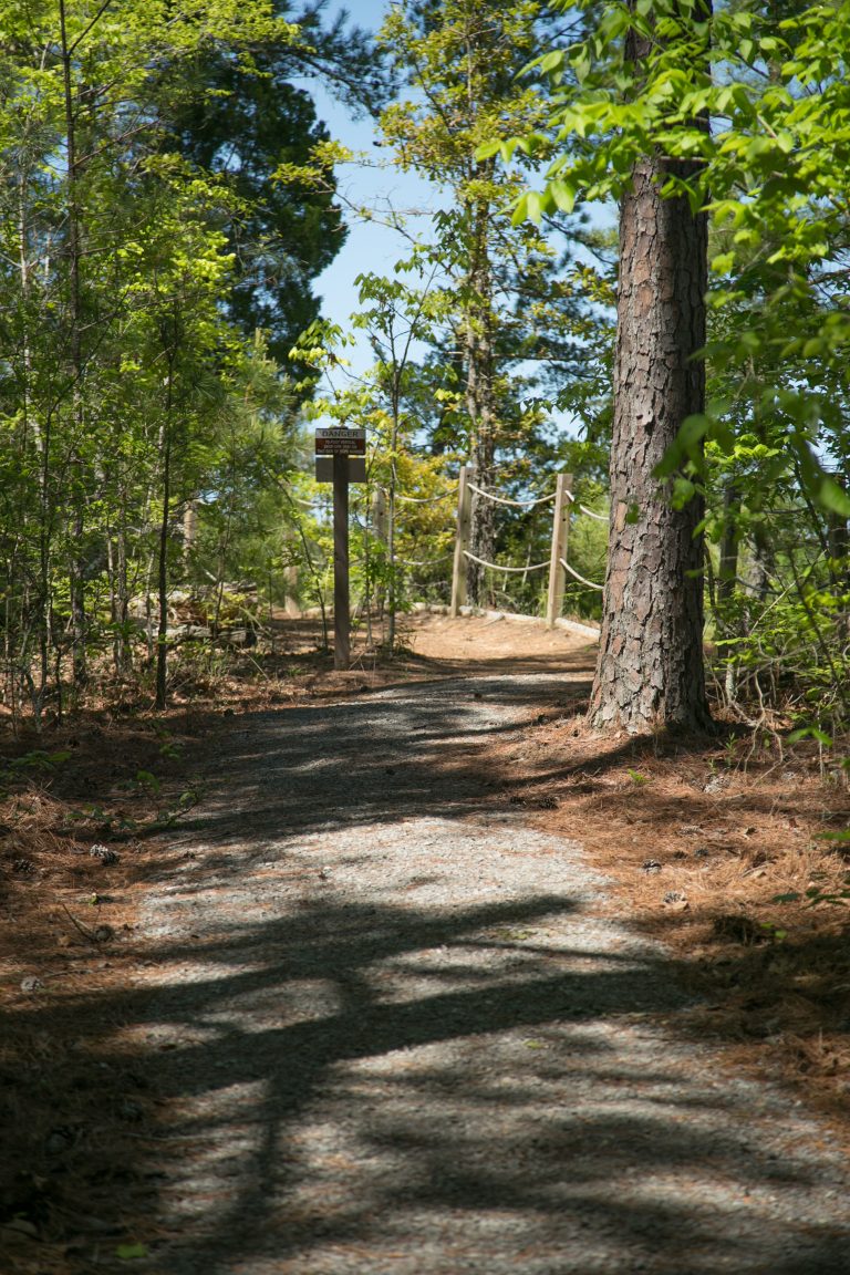
The Bluff Trail
The Bluff Trail is accessible from the Lake Trail at a gap in a fence that marks the boundary between Corps of Engineers property and adjoining University property. This 1.1 mile loop, all on University property, is surfaced almost entirely with crushed limestone and winds through upland woods and along the top of the 70-foot-high Bluff, providing and excellent view of the old Tombigbee River channel.
Steps at a ravine on the Bluff Trail (near the cottage on University property) may be difficult for some handicapped users. The total distance from the conference building parking lot, around both loops (Lake & Bluff Trails) and back to the parking lot is 1.75 miles.
Cretaceous Period
Many of the fossils found at Plymouth Bluff are from the Cretaceous Period (145 - 66 million years ago). At that time, Plymouth Bluff was underneath an inland sea.
Old Channel Trail
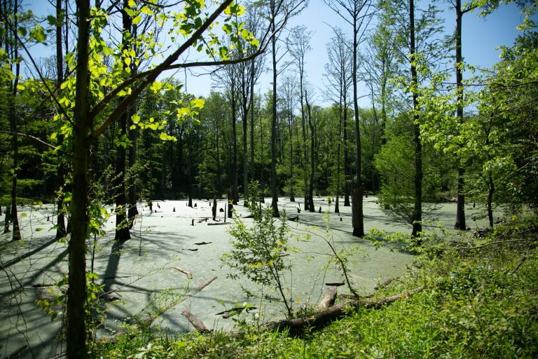
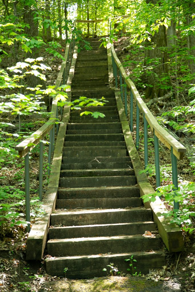
The Old Channel Trail begins at the observation deck back of the Conference Building and goes along the top of the bluff and down steps to the sandstone shelf at the base of the bluff. It then continues as a natural-surfaced trail along the shelf to other steps below the cottage on University property, where it joins the Bluff Trail. The base of the bluff along the shelf portion of the Old Channel Trail is the best place to look for Cretaceous fossils.
The distance from the observation deck to the junction with the Bluff Trail is 0.5 miles. The steps at each end of the trail (down to the base of the bluff) may be difficult for handicapped users.
River & Scout Trails
These two trails form a 1.5 mile loop that can be accessed from the guest cabins parking lot. Follow the asphalt trail that runs parallel to the entrance drive for a short distance and then turns into the woods behind the Director's residence.
The RIVER TRAIL begins with 64 steps down to the floodplain. The first .25 mile of the trail along the old Tombigbee River channel has an asphalt surface up to a rest area next to a wildlife feeding plot. It then continues along the Tenn-Tom Waterway and through the floodplain woods with a crushed limestone surface. Two Riverview Rest Areas along the way provide a chance to see an occasional river barge up close.
The River Trail follows a terrace between two cypress sloughs that provide excellent habitat for wood ducks and other wildlife. This terrace is a profusion of color when the abundant Red Buckeyes are in full flower in March. The trail continues along the base of a wooded slope (with many small footbridges) until it joins the Scout Trail.
The Howard T. Williams SCOUT TRAIL is a .25 mile section with a native (natural) surface. This proceeds gradually up the wooded slope back to the top of the steps. Enjoy some quiet time at Meditation Pointe, gazing down-slope at the floodplain forest. You may be treated to a white-tail deer or a red or gray fox wandering about.
The 64 steps at the beginning of the River Trail and the relatively steep slope of the lower part of the Scout Trail may be difficult for some users, but the entire River Trail (after the steps) is on mostly level ground. The total hiking distance from the parking lot, around the loop, and back is about 1.75 miles.